Its Sunday morning, stunning blue skies and cold temperatures forecast. You don’t want a full Scottish epic or 6am start but do want a leg stretch and a summit so what do you do?
You head to Ben A’an !

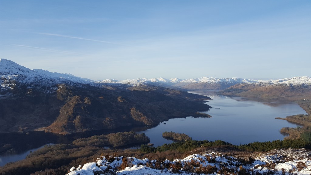
Ben A’n on the banks of Loch Achry (and close to the very beautiful Loch Venacher) in the Trossachs range is only a modest 454m high and can be done if moving at pace in under 2 hours (as I did recently) but offers the perfect mini mountain adventure.

Why do I say this?
A) Its in the heart of The Trossachs so offers the approaches and drive in that is part of the mountaineering “journey”.
B) it has steep sections to get the legs and hearts pumping, easy strolling sections to enjoy chatting and the views, bridges over babbling burns, a small seating areas half way upto take a drink and just enjoy the vista, a rocky steep summit approach that is more akin to something more grand…
and C) the views from it pointy summit are truly stunning – across to Ben Venue and behind it the mass of Ben Lomond, along the impressive water of Loch Katrine , to Ben Ledi at Callander and to Beinn Ime and behind you on a clear day to Ben More, with everything in between. … Its at this point I remind all readers I am hopeless still at identifying all but a few mountains from a distance but reviewing the map I’m pretty certain of these being right!


The one downside and its somewhat minor in my opinion is that recently the forestry area was cleared as part of the ongoing and necessary cycle of management but while we lose a forest walk we gain views
Up and at em yesterday then, joined those others with the same idea and up we went, negotiating the icy steps, enjoying it immensely, having a bite to eat on the summit, taking pics and just “being there” and then back down for lunch.


Superb!
For the full description to Ben A’an and for other maps and walks check out the brilliant Walkhighlands.co.uk


Leave a comment